Smart Digital Geofencing for Fleet Management
A geofence is a virtual geographic barrier. Its purpose is to define specific areas on a map for monitoring aircraft, vessels, personnel, or other assets entering and exiting the “fenced” perimeter.
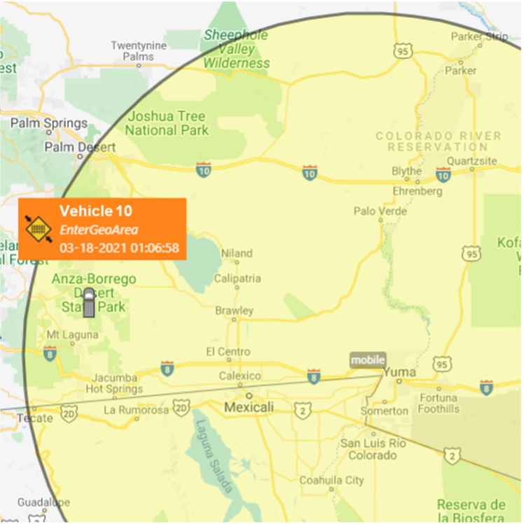
In most cases, geofences are configured to trigger an activity-based event. The event is a short message that includes a code ID, location coordinates, and time details. Events are then decoded by the organization’s fleet management software for manager notifications and reporting.
A common use for geofences is to mark inclusion zones. Inclusion zones are approved areas of operation where the asset is expected to be located. In most cases, the asset would not be tracked in this area unless it exited the designated inclusion zone. Tracking only outside the inclusion zone can help prevent unnecessary activity-based events from populating in one location. This geofence configuration can also save on service costs, especially in remote areas where events must be sent using a satellite network connection. Another option is to set event reporting intervals to only activate at specific times.
SkyRouter™ is Blue Sky Network’s cloud-based fleet management system for land, sea, and air applications. This dual-mode tracking and analytics solution offers both inclusion and exclusion geofence zone settings. This flexibility allows for easy identification and tracking of approved work zones, high-security areas, and restricted locations. Typical inclusion zones may include crop dusting fields, energy platforms, and quarries, while exclusion zones may include no-fly zones, marine protection areas, and hazardous sites.
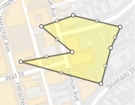 SkyRouter™ allows the creation of multiple geofences in a variety of shapes and sizes. Geofences may be in the shape of a simple circle or custom polygon arranged to fit any topographical requirements. Positions can also be fine-tuned to match exact coordinates.
Blue Sky Network offers a suite of tracking tools that integrate with SkyRouter for a seamless fleet management experience. When using these devices, a geofence breach can trigger an instantaneous event message to SkyRouter. This is a device-side event process. For other tracking hardware that may not include this direct notification functionality, breach conditions may be created through SkyRouter. This is called a server-side event process.
Contact us today for information about geofences, dual-mode tracking solutions, and Blue Sky Network’s SkyRouter fleet management platform.
—
Did you enjoy this post? Sign up for our newsletter to receive similar articles directly in your inbox!